|
|
|
|
|
|
|
|
PART 103 FAA Regulations
PART 103 ULTRALIGHT VEHICLES (regulations)
AC 103-6 - ULTRALIGHT VEHICLE OPERATIONS AIRPORTS, AIR TRAFFIC CONTROL, AND WEATHER
|
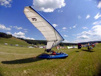
Ultralight Operations Let it be known that the Federal Aviation Administration (FAA) is excited about the developing technology and enthusiasm coming from the increase in active sports flying vehicles. The FAA’s posture regarding the operations of an ultralight vehicle is to ensure that all participants adhere to all of the applicable Federal Aviation Regulations (FAR) for safe operating practices. FAR Part 103 was adopted in 1982 as the operating rules regulating the ultralight vehicles. Remember that the safety record of ultralight vehicles will be the foremost factor in determining the need for further regulations. If you operate an ultralight vehicle you are expected to know, understand, and comply with FAR 103 requirements before operating the vehicle.
Determining FAR PART 103 applicability versus aircraft certification the following is a guide. 1. The maximum empty weight of a powered ultralight vehicle is limited to less than 254 pounds with exclusions for parachutes and floats. 2. To be classified as an ultralight, an aircraft must have a power-off stall speed which does not exceed 24 knots calibrated speed. 3. An ultralight with provisions for more than ONE OCCUPANT must be operated as a certified aircraft, even when operated by only one person, unless the operator has an exemption. Exemptions have been issued to allow training in two-place ultralights without requiring the operator to comply with applicable pilot and aircraft certification regulations. 4. If any of the above restrictions are not met, then the aircraft must be certified and the pilot must hold a pilot license. If the purpose of the flight was for hire, advertising, banner towing, agricultural spraying, patrolling a fence or any operation that is not sport or recreational usage, FAR PART 103 does not apply and the vehicle may be certified and operated under the applicable regulation. (Further explanations are included in AC-103-7.) All exemptions must be applied for from your FAA office and must be in your possession. A certified mechanic or repair station can determine the vehicle’s weight. An FAA certified mechanic may also make determinations and provide satisfactory evidence as to maximum fuel capacity and maximum level speed, provided that the maximum speeds were determined through the use of graphs provided in the appendices 1 and 2 of AC 103-7. The FAA is very interested in promoting and monitoring your sport with the major emphasis on aviation safety. Remember safety first and the enjoyment will always be there for everyone. Gary M. Pollak, FAA Operations Inspector Helena, Montana FSDO |
|
PART 103 ULTRALIGHT VEHICLES (regulations) AC 103-6 - ULTRALIGHT VEHICLE OPERATIONS AIRPORTS, AIR TRAFFIC CONTROL, AND WEATHER
|
|
|
OTHER FINE CITY SITES
|
CURRENT CHARLESTON WEATHER
|
|
See some of the Charleston Area's most beautiful scenery, captured by a genuine Charleston treasure, Margie DeCarli! Click on the photos below to see Margie's online gallery.
|
![]()
|
AC 103-6 - ULTRALIGHT VEHICLE OPERATIONS AIRPORTS, AIR TRAFFIC CONTROL, AND WEATHER Department of Transportation Federal Aviation Administration 6/23/83 Initiated by: AAT-230 1. PURPOSE. This advisory circular provides guidance for the operation of ultralight vehicles in the United States. Information includes airport and flight park operations, how to work with air traffic control, and the availability of weather services. Additional advisory circulars for the operation of ultralight vehicles may be found under series103. 2. BACKGROUND. a. The sport of hang gliding has advanced dramatically since the Federal Aviation Administration (FAA) first issued Advisory Circular No. 60-10, "Recommended Safety Parameters for the Operation of Hang Gliders," on May 16, 1974. The purpose of that advisory circular was to provide guidance to the hang gliding community without the need for Federal regulation. The response to the guidelines of the advisory circular was excellent, and for the period immediately following its issuance many of its safety goals were maintained. But, as the sport advanced, the performance capabilities and popularity of these vehicles increased. Many unpowered gliders became capable of soaring to altitudes more than 10,000 feet above the launch point, and flight distances could exceed 100 miles. The addition of powerplants and controllable aerodynamic surfaces created vehicles which approximate the operational capabilities of fixed wing aircraft. And with the greatly increased number of these vehicles, the operation of ultralight vehicles became a significant factor in aviation safety. b. On October 4, 1982, a new Federal Aviation Regulation, Part 103,became effective and provided for the safe integration of ultralight vehicle operations into the National Airspace System. In conjunction with Part 103, the ultralight community is being encouraged to adopt good operating practices. This advisory circular is intended to assist the ultralight operator in attaining that goal. Comments and questions concerning information contained in this advisory circular should be directed to Federal Aviation Administration, Airspace and Air Traffic Rules Branch (AAT-230), 800Independence Avenue S.W., Washington, D.C. 20591. 3. EXPLANATION OF CONTENTS. a. Chapter 1. Airports and Ultralight Flight Parks. Includes information about where to take off and land, the operation of a flight park, and environmental considerations. {p1}
b. Chapter 2. Air Traffic Control and Radio Communications. Describes airspace areas, operations at airports with and without control towers, and use of a two-way radio. c. Chapter 3. Weather Information. Sources of weather information, and an introduction to micrometeorology. d. Chapter 4. Accident Information and Other Sources. What to do if you witness or are involved in an accident. Also, where to go and what to do if you need additional information on the operation of your ultralight. 4. - 9. RESERVED. {p2} CHAPTER 1. AIRPORTS AND ULTRALIGHT FLIGHT PARKS 10. WHERE TO TAKE OFF AND LAND. One of the questions most frequently asked by the ultralight pilot is, "Where can I safely and legally take off and land my ultralight?" The following information is designed to assist the ultralight pilot in understanding the different types of operations, both on and off airport, and the recommended procedures for obtaining permission to operate ultralight vehicles. a. Existing airports. Currently, there are approximately 16,000 public use and private airports and seaplane bases in the United States. The vast majority of these facilities may be suitable and compatible for safe ultralight operations. Information on their location may be obtained from various sources, such as FAA publications (i.e., Airport / Facility Directory, aeronautical charts, etc.) which may be purchased at most local airports. Also, user organizations have comprehensive airport listings which usually include a description of the facility. Items to Consider (1) Some of these airports have their air traffic directly controlled by an air traffic control tower. Use of these airports requires prior permission of airport management and the local air traffic control authority (see FAR Part 103.17). Since the volume of aircraft operating at these airports is usually significantly higher, ultralight operators may find operations at these airports to be less desirable than operations at uncontrolled airports. (2) There are many airports where air traffic is not controlled by an air traffic control tower and the traffic activity level is usually low. These airports are referred to as "uncontrolled airports." Use of these airports by ultralight vehicles may require prior permission of the airport operator. When seeking access to these airports, ultralight operators should remember that even though the airport may be tax supported, airport management has the responsibility for determining the compatibility of operating the various classes of aircraft on the airport. If an ultralight can be safely operated at the airport, then permission to operate the ultralight vehicle may be granted. Safety of aircraft operations on the airport is always the prime consideration. b. Abandoned Airports. Since 1970, approximately 3,000 airports have been abandoned because of a lack of activity, financial problems, or other related reasons. The majority of these airports are located in rural areas, privately owned, and possibly well suited for ultralight training and other activities. Many state aeronautical organizations have knowledge of recently abandoned facilities and should be able to assist you in finding these sites. It may be possible to obtain permission of the property owner to reactivate certain of these facilities for ultralight operations. {p3}
c. Open Space Operating Areas. One of the prime advantages of ultralight operation is the vehicle's ability to operate in small areas. FAR Part 103 does not prohibit ultralight takeoff and landing from open areas, providing the operation does not over fly congested areas. Good judgment still dictates that an ultralight pilot obtain prior permission from the landowner and be familiar with the terrain and obstructions at any location where operations are intended. For the operation of hang gliders, special consideration should be given to the terrain surrounding the launch site. In many cases these terrain features will influence the ability of the unpowered craft to return to the launch site. 11. OPERATION OF A FLIGHT PARK. Anyone wishing to establish a site for the operation of ultralight vehicles should be aware of the following Federal, state, and local regulatory requirements which may apply to these operations: a. Federal Requirements. Unless the site is to be used solely in VFR weather conditions for a period of less than 30 consecutive days with no more than 10operations per day during this period, notification of the intent to establish a flight park is required under the provisions of FAR Part157, Notification of Construction, Alteration, Activation, and Deactivation of Airports. FAA Form 7480-1, which is used to provide this notice (as well as guidance in its preparation) is available from any FAA regional Airports Division or Airports District / Field office. The FAA uses the information provided in the notice to advise on the effect of the establishment of the site on the use of navigable airspace by aircraft. Advisory Circular 70-2, Airspace Utilization Considerations in the Proposed Construction, Alteration, Activation and Deactivation of Airports, describes some of the factors which affect airspace utilization. Failure to provide the required notice violates Section 901 of the Federal Aviation Act of 1958 and carries a possible civil penalty. b. State Requirements. Many state aviation departments require approval and a license for the establishment of a site for aeronautical operations. The potential ultralight flight park developer should contact the state aviation authorities to determine state requirements. c. Local Requirements. Most communities have established zoning laws, building codes, fire regulations, and other legal requirements to provide for the safety and comfort of the citizenry. A thorough study of these requirements should be made to determine their effect on the establishment and operation of an ultralight flight park. 12. STANDARDS FOR THE FLIGHT PARK LAYOUT. The FAA has no standards for the geometric design of an airport built to exclusively serve ultralight vehicles. However, several ultralight organizations provide information which may be useful for the establishment of an ultralight flight park as a separate entity. FAA Advisory Circular 150/5300-4B, Utility Airports - Air Access to National Transportation, intended for airports serving aircraft with approach speeds less than 121 knots, provides guidance which may also be helpful in developing an operational site for ultralight aircraft. 13. NOISE CONSIDERATIONS. Perhaps the most limiting factor in the operation of ultralights is the noise emitted from the vehicle. Unless proper measures are taken in the design and operation of ultralights, public annoyance to the noise may result in restrictive local and state regulations. Acceptance by the public of recreational sport flying is significantly tied to the potential for annoyance from the vehicle's noise. {p4}
a. Significant progress has been made by ultralight manufacturers to quiet engine, exhaust, and propeller noises. As these systems continue to improve, so will the acceptance of the ultralight vehicle. However, these improvements are only half of the story. Ultralight operation in a manner sensitive to the possible annoyance of those on the ground is the other. It is probably the most important factor in gaining acceptance by the general public. b. Airport owners / operators have been trying for years to establish operations compatible with the needs of adjacent communities. The acceptance of ultralight operations by a community will depend in a large part on its perception of how additional operations by ultralights will affect the airport's overall compatibility with its neighbors. Careful planning by ultralight operators in integrating their vehicles into the existing operation will go a long way in making acceptance a reality. c. The FAA has begun ultralight noise testing. Preliminary results indicate that, in absolute noise levels, the ultralight is no louder at 1,000 feet AGL than some popular two seat single engine aircraft. The slower speed of the ultralight does result in longer periods of exposure to noise and is a significant factor in the annoyance perceived from such over flight. Another consideration is the lower altitude at which many ultralight operations take place. This causes an increase in the intensity of sound during flyover and is a significant factor in determining the annoyance caused by noise. d. FAR Part 103 prohibits operations of ultralights over congested areas. Ultralight pilots should be aware that, while their vehicles may not be operating directly over congested areas, their vehicles' noise may carry to the residents of a nearby congested area. 14. FLIGHT PARK DATA. Once the ultralight flight park is activated by the operator and the FAA is notified, an Airport Master Record (FAA Form 5010-2) is prepared by the FAA. This is a computerized record of data describing the flight park's facilities and services. Each year, a copy of this Airport Master Record is mailed to the flight park operator with a request to verify and update the data. The information collected by the FAA is available upon request to Government agencies, aviation organizations, aviation industries, and private individuals. Future informational needs for ultralight flight park directories, charting, etc., can be supplied from computerized data summaries derived from the Airport Master Record. 15. - 19. RESERVED. {p5}{p6 blank}
CHAPTER 2. AIR TRAFFIC CONTROL AND RADIO COMMUNICATIONS 20. GENERAL. The rapid growth and popularity of ultralight vehicles and the increased number of operations require the highest degree of vigilance on the part of ultralight operators to see and avoid other ultralight vehicles and aircraft. Some of these operations involve authorization from air traffic control. The purpose of this chapter is to assist the ultralight operator in understanding the airspace, operations with air traffic control, and the use of radio communications. 21. AIR TRAFFIC CONTROL (ATC) AND AIRSPACE. Even though ultralight vehicle operators are not required to demonstrate any aeronautical knowledge or experience requirements, failure to recognize and avoid certain airspace can be hazardous and may be in violation of the Federal Aviation Regulations. FAR 103.17states that no person may operate an ultralight vehicle within an Airport Traffic Area, Control Zone, Terminal Control Area or Positive Control Area unless that person has prior authorization from the air traffic control facility having jurisdiction over the airspace. The airspace areas requiring ATC authorization that you, as an ultralight operator, are most likely to come in contact with are the Airport Traffic Area, Control Zone and Terminal Control Area. 22. AIRSPACE AREAS. a. What is an Airport Traffic Area (ATA)? An Airport Traffic Area is airspace within a radius of 5 statute miles from the center of an airport, with an operating control tower, that extends upward from the surface to, but not including, an altitude 3,000 feet above the elevation of an airport. For the purpose of ultralight operations, flight within the ATA requires specific authorization from the air traffic control tower. Although most ATAs are not depicted on charts, any airport symbol on the sectional chart that is blue in color indicates the presence of an air traffic control tower. During the time that tower is in operation, an ATA exists (see item h., Airspace and the Chart). b. What is a Control Zone? A Control Zone may include one or more airports and is normally a circular area within a radius of 5 statute miles around an airport. The vertical limits of a control zone begin at the surface and extend upward to 14,500 feet mean sea level (MSL). Some control zones have rectangular extensions to include the arrival and departure paths for pilots operating primarily with reference to their aircraft instruments. The entire area of a control zone is considered controlled airspace, but not all airports have a control zone. Where a control zone exists, it is depicted on sectional charts by the use of dashed lines. For the purpose of ultralight operations flight within the control zone requires authorization from the air traffic facility controlling that area. {p7}
c. What is a Terminal Control Area (TCA)? At the present time there are 23 Terminal Control Areas. TCAs are in place around many of the high density airports in the country. They extend upward from the surface in the center and usually have multiple rings of airspace which extend outward horizontally. Its appearance closely resembles an inverted wedding cake, with both lower and upper limits for each ring. The presence of a TCA is characterized on a sectional chart by blue outlines of the TCA limits around a major airport. All operations within the rings of a TCA require authorization from air traffic control (see item h., Airspace and the Chart). d. What is Positive Control Area (PCA)? Positive Control Area is the area which overlies the continental United States at 18,000 feet and above. All operations conducted in PCA are done so with the authority of air traffic control. Aircraft operating at these higher altitudes are required to carry additional radio equipment and their pilots must be rated for instrument flight. Although ultralights are not faced with specific equipment requirements for entry into PCA, ATC authorization is required. Requests for such flights will be thoroughly reviewed prior to any decision to authorize operations in PCA by an ultralight. e. How Do I Get ATC Authorization? Requests for authorization to operate an ultralight vehicle into one of the above named areas should be made by writing, telephoning, or visiting the air traffic control facility having jurisdiction over the airspace in which you wish to operate. Requests for such authorization via air traffic control radio communication frequencies will normally not be accepted, since it may interfere with the separation of aircraft. f. What is Uncontrolled Airspace? Uncontrolled airspace is the area in which air traffic control separation services are not provided. This area is usually below 1,200feet above ground level (AGL). When nearing airports with established instrument approaches, the ceiling of uncontrolled airspace usually lowers to 700 feet AGL, and, if a control zone exists, uncontrolled airspace remains outside of the control zone horizontal limits, thus putting the airport within controlled airspace. In some geographic areas, primarily west of the Mississippi River, uncontrolled airspace ceilings are above 1,200 feet AGL. This is an exception, rather than the rule. The ceiling of uncontrolled airspace may be determined by reference to Sectional Aeronautical Charts used for aviation (see item h., Airspace and the Chart). g. What is Controlled Airspace? Controlled airspace is the area in which air traffic control separation services are available for aircraft. The base of controlled airspace usually begins at 1,200 feet AGL and extends upward. When nearing airports with established instrument approaches the base of controlled airspace usually lowers to 700 feet AGL, and, if a control zone exists, the base of controlled airspace begins at the surface within the horizontal limits of the control zone. (See Item h., Airspace and the Chart) {p8}
h. Airspace and the Chart. Sectional Aeronautical Charts, often called "sectionals", are published by the National Oceanic and Atmospheric Administration (NOAA) and are revised on a semiannual basis. Sectionals depict information for the use of pilots who are operating with visual reference to the earth's surface. Each sectional has a legend printed on its end flap. Of particular interest to the ultralight operator, is the portion entitled "Airport Traffic Service and Airspace Information." This portion of the legend gives information which will enable you to locate the floor of controlled airspace, prohibited and restricted areas, TCAs, control zones, tower controlled airports, obstructions, and other useful information. Sectional charts may be purchased from local airport operators, user organizations, and directly from the NOAA, Washington, D.C. Assistance in learning how to use sectional charts should be readily available from any FAA certificated flight or ground instructor. i. Special Military Activity. (1) There are special routes, known as Military Training Routes (MTRs), which have been developed across the country for military training in "low level" combat tactics. Generally, MTRs are established below 10,000 feet MSL for operations at speeds in excess of 250 knots and will include operations by both fighter and cargo type aircraft. The routes at 1,500 feet AGL and below are developed primarily to be flown in visual flight weather conditions. The sectional charts depict regularly established MTRs as shaded gray lines with an associated VR or IR numbered identifier. Nonparticipating flights are not prohibited from flying within an MTR, but extra caution to see and avoid these operations is imperative in attaining the greatest practical level of safety. Ultralight pilots and flight park operators should contact the nearest Flight Service Station (FSS) to obtain information on the route usage in their vicinity. Information available includes times of scheduled activity, altitudes in use, and actual route width. Route width varies for each MTR and can extend several miles on either side of the line depicted on sectional charts. (2) Also, throughout the year, the military conducts special operations which may be held on a one-time basis in a specific geographical location. Information pertaining to such operations is usually available through the FSS system. When requesting MTR and special activity information, ultralight operators should give the FSS their area of intended operation and permit the FSS specialist to identify the MTR routes and special activities which could be a factor. Information on FSSs may be found in paragraph 42(a). 23. TRAFFIC PATTERNS AND OPERATIONS IN THE VICINITY OF AN AIRPORT. a. Since the speed and operating characteristics of an ultralight vehicle may be incompatible with many aircraft, it is essential that you stay alert by looking for and avoiding other traffic. Be especially aware of the possibility that a faster craft might overtake your ultralight. Ultralight operators should be especially vigilant for aircraft operating around an airport. Traffic pattern altitudes for propeller driven aircraft generally extend from 600 to 1500 feet above the ground and aircraft are often at these altitudes within 5miles of the airport. Also, because of the possible effects of wake turbulence, operations in close proximity to aircraft of greater speed and weight should be avoided. b. Preparatory to landing at an uncontrolled airport, the pilot should be concerned with landing direction indications on the airport. Such indicators include wind socks, wind tees, tetrahedrons, traffic pattern indicators, and the direction of other fixed wing operations. c. Wind socks operate freely and are subject to the forces of wind for direction. Wind tees may move freely or be aligned manually indicating the preferred landing direction. A tetrahedron is a large kite-shaped indicator sometimes located beside the runway and may move freely or be set manually. The small end of the tetrahedron points in the preferred direction of landing. {p9} d. Many airports have standardized traffic patterns which rely on all turns in the pattern being made to the left. Traffic pattern indicators are used when there is a variation from the normal left traffic pattern. They are located either in a segmented circle with the wind sock or tetrahedron, or may be located near the end of the applicable runway. If the pilot will mentally enlarge the indicator for the runway to be used, the direction of turns will become readily apparent. Airports which have parallel runways may have both left and right traffic patterns operating at the same time. e. Also, some airports may have a specific area designated for ultralight operations. Look for any indications that landings are to be made on other than the main runway and adjust your flight path so as to not conflict with operations to the main runway. f. Regardless of wind indicators or traffic patterns, it is wise to scan the airport surface and the surrounding airspace for flights that may be operating in a different manner. The governing factor as to which runway is in use is the direction and strength of the wind. It is the responsibility of pilots to determine the safe landing direction for their craft. The indicators are there to assist you in operating safely, but they are not meant to be a substitute for careful vigilance and good judgment. {p10}
24. OPERATIONS AT AIRPORTS WITH A CONTROL TOWER. If you are operating into or out of an airport with a control tower expect to be segregated from all non-ultralight aircraft in the traffic pattern, in the use of runways, and on the airport surface. Please take special notice of the word "segregate." FAA air traffic controllers have been advised to authorize ultralight operations only if they will not interfere with and can be kept relatively clear of normal aircraft operations. Certificated aircraft receive separation services. These will not be available to ultralight pilots. Rather, ultralight pilots will be expected to separate themselves from each other and also to remain clear of all normal aircraft operations. When requesting to operate at a tower controlled airport, or within the airport traffic area, expect the controllers to provide you instructions as to what areas to avoid. These instructions may include route and altitude information as well as a specified landing area. Specific times during which to operate may also be authorized. For operators equipped with two-way radios, see paragraph 25. It is important that ultralight operators understand the responsibility for avoiding a conflict with aircraft and other ultralights is theirs, and theirs alone. 25. USE OF A TWO-WAY RADIO. The following information provides guidelines for the use of a two-way radio while operating an ultralight. a. Communications with Air Traffic Control. In all radio communications with air traffic control, ultralight operators should state the word "ultralight" followed by the call letters assigned by the F.C.C. on your radio license, i.e., "Ultralight 12593U." Use of the following radio communication practices will result in the controller having a better understanding of your request and enhance the safety of your flight. (1) Determine the correct frequency from a Sectional Aeronautical Chart. (2) Contact the air traffic control tower prior to entering the area for which you are requesting authorization. (3) Speak slowly and distinctly. If you do not get an immediate reply, wait a few moments, then repeat your request. The controller may be busy and you may not be hearing all of the transmissions the controller is hearing. (4) State the facility you are calling, your ultralight identification, altitude, and location relative to the airport. Example: "Sample Tower, Ultralight 12593U Six Miles Southwest at 1,000feet." If you are on the ground at the airport, give your position on the airport. (5) Wait for the tower to respond before stating any further information. (6) Once two-way communications are established, briefly state your request. (7) Keep in mind at all times your responsibility to remain clear of all other aircraft and ultralights. Further, remember your responsibility to remain clear of any area for which an authorization is required, but has not been received. (8) On occasion, air traffic control will deny authorization to operate in a specific area. This is not unique to ultralights. At times, certificated pilots in sophisticated aircraft are also denied access to certain areas. Factors affecting authorization are the nature of the requested operation, the effect on other operations that may already be taking place, controller workload, and equipment or facility limitations. The ultimate reason remains the same ... SAFETY. {p11}
b. Communications at Uncontrolled Airports. (1) An uncontrolled airport is an airport without a control tower or where the control tower is not currently in operation. This does not mean that two-way communications are not used. Quite the contrary. A considerable amount of useful information is passed back and forth among pilots and the operators of airport advisory frequencies. Information such as runway in use, surface winds, other aircraft known to be in the area, and any unusual activities, such as parachuting, may be available. (2) There are three primary ways for ultralight operators, who are radio equipped, to communicate their intentions and obtain airport/ traffic information when operating at a landing area that does not have an operating control tower: (i) by communicating with an FAA flight service station located on the airport; (ii) by communicating with a local airport advisory operator located at the airport; or (iii) by making self-announce broadcasts of intentions over a commonly used frequency for operations at that airport. (3) The key to communicating at uncontrolled airports is selection of the correct Common Traffic Advisory Frequency (CTAF). Amore detailed explanation of CTAF and traffic advisory practices and good operating procedures can be found in FAA Advisory Circular 90-42Cand the Airman's Information Manual. Additionally, the Airport /Facility Directory provides information on which frequency to use at a particular airport. c. Traffic Advisory Practices at Uncontrolled Airports. In all radio communications, ultralight operators should state the word "ultralight" followed by the call letters assigned by the F.C.C. on your radio license, i.e., "Ultralight 12593U". (1) Select the correct frequency, many of which can be found on Sectional Aeronautical Charts. (2) Contact the airport advisory service prior to entering the area or departing the airport. (3) Speak slowly and distinctly. If you do not get an immediate reply, wait a few moments and repeat your request. Please note that pilots announcing their departure are not normally acknowledged. (4) State the facility or airport you are calling, your ultralight identification, your location relative to the airport, and your intended operation. Example: "Leesburg, Ultralight 12593U is 5Miles North, Landing." (5) If you still do not get a reply, proceed cautiously toward the airport. If departing the airport, be careful to visually clear the area in all directions prior to entering the takeoff area. Remain on the proper radio frequency and listen for any aircraft which may be in the area. {p12} (6) Once you have completed your landing or have exited the area, it is good practice to let other aviators know that you are no longer airborne in the vicinity of the airport. Example: "Leesburg, Ultralight 12593U is Clear of the Runway" or "Leesburg, Ultralight12593U is 2 Miles South, Leaving the Area". 26. - 29. RESERVED. {p13}{p14 blank}
CHAPTER 3. WEATHER INFORMATION The desire to leave the ground and explore the world from the air has inevitably tied you to weather and its effect upon you. No pilot, amateur or professionals can safely attempt a flight without considering the present and expected weather conditions. Weather is a factor in most aviation accidents. It cannot be emphasized too strongly that if you are to continue to operate safely, it is essential to know and understand the environment in which you are flying. Individual pilot weather briefings from FAA flight service stations are provided to pilots on a "first come, first served" basis. The number of briefers available today is insufficient to meet user demands without the prospect of considerable delays. The FAA is taking steps to remedy this. An automated system currently under development is designed to accommodate direct user access and will be able to provide increased services. Until that system is operational, the present FAA flight service system may not be able to accommodate all the needs of ultralight fliers. 30. SOURCES OF WEATHER INFORMATION. Many sources of weather data are available to aviators. The following sources will assist you in acquiring and evaluating as much weather data as possible. a. National weather is broadcast weekdays in a live 15 minute television program called AM Weather. The program is carried by about250 public broadcast stations in the early morning. This program features meteorologists from the National Weather Service and the National Environmental Satellite, Data, and Information Service (NESDIS). They use the latest guidance and data available to produce a thorough program. The program's surface and forecast maps, satellite imagery, radar maps, and upper air charts, along with the hazardous weather watches, are ideal for acquiring broad scale weather information. Consult your local television schedules to obtain time of broadcast in your area. b. Many cable TV systems now include 24 hour weather channels. Some of the programs include aviation weather. c. Transcribed Weather Broadcasts (TWEB) for aviation are made on numerous FAA VHF omnidirectional ranges (VOR), nondirectional radio beacons (NDBs), and at selected airports that provide automatic terminal information services (ATIS). These transcribed broadcasts are continuously updated during their hours of operation. d. Broadcasts over radio beacons are made in the range of 200 - 400KHz and can be received on relatively inexpensive radio receivers. VOR and ATIS broadcasts are made on VHF aviation radio frequencies between108 - 136 MHz. There are many moderately priced radios available that will receive these frequencies. e. The content of TWEB and ATIS broadcast in some cities can be received over the telephone. The telephone numbers to use can be found in the telephone directory under United States Government, Department of Transportation, Federal Aviation Administration. TWEB recordings will be listed under Flight Service Station and ATIS recordings will be listed under Air Traffic Control Tower. {p15}
f. On nondirectional radio beacons and selected VHF omnidirectionalranges (VORs), the broadcasts may include synopsis, adverse conditions, route forecasts, outlook, winds aloft forecasts, radar reports, surface weather report, etc. g. Broadcasts on other VORs may include only surface weather reports, terminal (airport) forecast for the local airport, adverse conditions, etc. h. ATIS broadcasts may include local ceiling, visibility, obstructions to vision, temperature, wind direction (magnetic) and speed, altimeter setting, etc. The information is applicable only to the airport located at the ATIS site, but it may be used in evaluating the trend of existing weather. i. All the above facilities and their frequencies may be identified by studying sectional aeronautical charts that are sold at many airports. Much of the same information is found in the U.S. Government Flight Information Publication, Airport / Facility Directory. Comprehensive explanations of all these services are printed in the FAA Airman's Information Manual (AIM). The publication is available through the U.S. Government Printing office. Other excellent sources to find out frequencies and what is available, are pilots handbooks published by user organizations. j. In most large metropolitan areas, the National Weather Service provides continuous broadcasts of local weather conditions on two frequencies that can be received by inexpensive radios available at many retail outlets. k. Pilots Automatic Telephone Weather Answering Service (PATWAS) is available in most large metropolitan locations. This is a telephone recording of local and route weather information that can be obtained by dialing a telephone number found under the same heading in the phone book as listed above for TWEB. l. If you live in the Washington, D.C., or Columbus, Ohio, areas, you should become familiar with the voice response system (VRS) installed at these locations. This is a computer based test system that provides weather data over the telephone. The user needs only to have a "TOUCHTONE" phone to access the system. Since this is a test system, the products available may vary. The latest information available and directions on using this system can be obtained by sending a stamped self-addressed envelope to: Voice Response System DOT/FAA/FAATC ACT 110 Atlantic City, N.J. 08405 m. These many sources of weather data are only part of a safe weather operation. Other factors include a knowledge of how to interpret the weather data correctly, and when to exercise good judgment and not fly. There are many Government and civil sources that supply educational material on weather and user organizations are developing courses aimed at improving the ultralight operator's understanding of weather. One of the best efforts ultralight operator scan make in their own behalf is to find out about weather. Many members of the aviation community have learned that weather, above all other aspects of our environment, is irreverent of even the most experienced aviator. {p16}
31. MICROMETEOROLOGY. While the list of available weather information is impressive, it may not provide the ultralight operator with the actual weather and wind conditions at the operating site. One of the most critical factors in conducting a safe takeoff and landing is accurate information of the wind conditions on the surface. There may be many indications of what the wind conditions are at the flying site. The information provided herein is designed to assist you in understanding and using those indicators. a. Wind Direction. One of the best indicators of wind direction near the surface is derived by the use of a windsock or wind streamers. The direction of the wind is clearly indicated, as is the velocity. Because ultralight vehicles are very susceptible to wind, we recommend that several windsocks or streamers be located around the landing site. Another means of learning the wind direction on the surface is from nearby ponds or lakes. The "glassy" or smooth water area along the shore indicates the direction from which the wind is blowing. The further out into the body of water the glassy area protrudes, the lower the wind velocity. Be careful when using this method that the shoreline is not subject to major obstructions such as high trees or a steep, high bank. Yet another indicator of wind direction and velocity is the natural vegetation such as tall grass, trees, and bushes. Caution should be used here too, for the trees themselves can cause the wind direction to change significantly, see item c., Turbulence and Wind Shear. Other indicators of surface wind are smoke and blowing dust. Learn to use them all and learn to cross check the information of one against the other. They are inexpensive resources that may save your life. b. Wind Gradient and Gusts. Wind gradient is change in the velocity of the wind with an increase / decrease in altitude. Normally, wind velocities will increase as the altitude increases. Conversely, because of the drag effects of the earth, winds may significantly decrease as you get closer to the ground. If the winds decrease at a faster rate than can be accounted for by pitch and thrust changes, the vehicle may enter a stall. For this reason, when descending or climbing in close proximity to the ground, a safe margin of extra airspeed is recommended. Also affecting the ultralight vehicle are wind gusts. The danger inherent in gusting wind conditions is amplified during the takeoff and landing phases of flight. A sudden gust of wind could lift the ultralight up quickly, only to abandon the pilot 20 feet above the ground. The result is often a stall. Another effect of gusting winds is the effect on the airframe of the vehicle. Strong gusts could easily and quickly exceed the design limits of the vehicle, especially if the pilot is performing a maneuver which is already putting some "load" on the airframe. The best advice for operating in gusting winds is to ask yourself: "Do I really need to be doing this?" If you absolutely, positively have to be there, fly gently and maintain extra airspeed during the takeoff and landing. Fly the vehicle right down to the ground with a minimum landing flare, and, after you've landed, ask yourself: "Do I really want to do that again?" {p17}
c. Turbulence and Wind Shear. The most critical altitudes for microwind changes are between 30and 75 feet above ground level. This depends, in part, on the nearness of the surrounding obstructions such as large trees, buildings, and hills. The effect of these obstructions is often turbulence or a sudden change in wind direction and velocity often referred to as windshear. Turbulence can be especially dangerous in ultralights due to their light weight. Ground turbulence consists of vortices and eddies, vertical blasts of air, and rotors (dust devils). Turbulence is caused by winds moving across and around objects, and by thermal heating of the earth's surface. Wind shear can result in a sudden reduction in the relative wind over the vehicle's lifting surfaces. When this happens, the vehicle may very quickly enter a stall. At low altitude it may be nearly impossible to recover in the distance remaining to the ground. Because of the effects turbulence and wind shear have on the safety of ultralight operations, it may be wise not to fly ultralights in winds exceeding 15 mph. And even then, there will be some circumstances when 15 mph is too much. Also, keep in mind not only your own piloting skills, but the abilities of your craft to handle a crosswind during takeoff and landing. If you are in doubt, err on the side of safety and leave the enjoyment of flying for another time, perhaps another day. 32. - 39. RESERVED. {p18}
CHAPTER 4. ACCIDENT INFORMATION AND OTHER SOURCES 40. NATIONAL TRANSPORTATION SAFETY BOARD (NTSB). a. The NTSB is the official Government investigator for all transportation safety issues. Its purpose is to impartially analyze occurrences which may indicate a transportation safety problem and to recommend corrective action. The NTSB has decided to investigate all fatal powered ultralight vehicle accidents and other selected ultralight accidents and incidents which may involve significant safety issues. The Safety Board will also investigate ultralight vehicle accidents impinging on civil aircraft operations or on persons and property on the ground. The Safety Board will review accident data and the safety efforts of the aviation community in order to keep abreast of any emerging safety problems and will be available to provide technical assistance in remedying those problems. IF YOU ARE WITNESS TO OR INVOLVED IN AN INCIDENT / ACCIDENTIN VOLVING THE OPERATION OF AN ULTRALIGHT VEHICLE, NTSB REQUESTS YOU DO THE FOLLOWING: (1) Immediately attend to the medical and physical needs of the situation. Notify the local authorities if assistance is needed. (2) Do not move or remove any debris associated with the occurrence. (3) Write down as much as you can remember. This will be very helpful in accurately recalling the incident. (4) Notify, or have the local authorities notify, the nearest NTSB Field office. This information can be found in the local phonebook under U.S. Government, National Transportation Safety Board, or call your local FAA office and request the NTSB telephone number. (5) If you are able, take photographs of the site, and get the names and phone numbers of any witness. b. NTSB requests that you be very helpful in reporting such incidents as this will give all of the owners / operators of ultralights a chance to benefit from the knowledge gained during the investigation. The Safety Board investigation is fact finding in nature and will not be used to substantiate any violation of Federal Aviation Regulations. c. Additionally, the FAA supports the goals of private organizations and associations to provide technical and operational assistance to the ultralight industry in enhancing the reliability of the vehicles and the safety of the sport. The FAA encourages all participants in the sport of ultralight flying to report any incident, accident, structural or mechanical failure of an ultralight to the private organizations and associations actively representing the sport. {p19}
41. AIRPORTS DISTRICT OFFICE (ADO). a. Airport district offices are located throughout the country and serve a specific geographical area. Their primary purpose is to assist the aviation community and state and local governments in the planning and development of landing facilities. Under FAR 103, ADOs would be your best source for information pertaining to the establishment of a flight park and the environmental considerations associated with operations. b. For the phone number and location of the ADO serving your area, consult your local phone directory under Department of Transportation, Federal Aviation Administration, Airport District Office or Regional Airport District Office. 42. FAA AIR TRAFFIC CONTROL FACILITIES. There are three major types of air traffic control facilities with which you may come in contact. The following information should assist you in determining which one to call. a. Flight Service Station (FSS). The Flight Service Station's primary function is to provide the pilot with preflight weather briefings and also Notices to Airmen (NOTAMs) which have information as to the status of airports and facilities; the conduct of special activities (parachuting, airshows, military exercises, etc.); and the presence of known temporary structures such as a crane located near an airport. For the ultralight operator, FSSs can be a means of obtaining guidance on which FAA facility could best be of assistance. For the role FSSs play in providing weather information to ultralight pilots, see Chapter 3. b. Air Traffic Control Tower (ATCT). There are many air traffic control towers located throughout the country. Each serves a particular airport and provides pilots with information on the movement of other aircraft in and around the airport. In some circumstances, ATCTs have an approach control associated with them which provides separation between aircraft over a wider geographic area. Under FAR 103, ATCTs would be your contact point for operations in an airport traffic area. In many instances, operations at nearby airports with control zones may also be coordinated through the nearest ATCT. c. Air Route Traffic Control Center (ARTCC). There are 20 ARTCCs located around the country. Each one covers a very large geographic area and provides radar separation services to aircraft through the use of remote radar and radio communication facilities. In some areas, the ARTCC functions as an approach control and has responsibility, under FAR 103, for providing authorization for ultralight operations in a control zone. Due to the size and vast area of coverage of ARTCCs, it is better to contact the FSS or ATCT nearest you for assistance in obtaining required authorizations. For the phone numbers and locations of the FSS, ATCT, or ARTCC you wish to call, consult your local telephone directory under Department of Transportation, Federal Aviation Administration. Each facility should be listed separately: Flight Service Station; (airport name) Air Traffic Control Tower; and Air Route Traffic Control Center. {p20}
43. GENERAL AVIATION DISTRICT OFFICE (GADO). a. These offices are located throughout the country and are staffed by Flight Standards personnel. Their primary purpose is to serve the general public and aviation industry on all matters relating to the certification and operation of general aviation aircraft. These responsibilities include accident prevention programs, general surveillance of operational safety, and the enforcement of FAR. Under FAR 103, GADOs are your best source of information for items such as vehicle applicability, hazardous operations, and operations over congested areas. Should you desire, GADOs can also provide you guidance and assistance in certificating your ultralight as an aircraft. b. For the location and phone number of your nearest GADO, consult your local telephone directory under Department of Transportation, Federal Aviation Administration, General Aviation District Office or Flight Standards District Office. 44. PUBLICATIONS. The Federal Government and the aviation industry have devoted considerable energies to producing informational and training publications which are invaluable to pilots. Listed below are some of the publications available from the Superintendent of Documents, U.S. Government Printing Office, Washington, D.C. 20402. Other sources of useful information can be obtained through the various organizations, manufacturers, and associations working within the aviation community. a. Airman's Information Manual (AIM). This manual contains the basic fundamentals required for safe flight in the U.S. National Airspace System. It includes chapters on navigation aids, airspace, air traffic control, flight safety, and good operating practices. it also includes a pilot / controller glossary. The AIM is issued every 112 days and the annual subscription price is $17. b. Pilot's Handbook of Aeronautical Knowledge. This handbook contains essential information used in training and guiding pilots. Subjects include the principals of flight, airplane performance, flight instruments, basic weather, navigation and charts, and excerpts from flight information publications. This handbook is one of the most complete sources of aeronautical information available. The current price is $10. Listed below are some of the publications available from the FAA. c. Flight Standards Safety Pamphlets. These pamphlets are used in the General Aviation Accident Prevention Program and are produced primarily to be distributed at accident prevention seminars by GADO personnel. Titles available include: Density Altitude, Weight and Balance, Propeller Operation and Care, and Planning Your Takeoff. There are many other subjects available. Pamphlets may be obtained in reasonable number at no charge from the FAA Accident Prevention Specialist assigned to your local GADO. d. FAA Advisory Circulars. (1) The FAA issues advisory circulars to assist and inform thepublic on matters affecting aviation. Advisory circulars are issued ina numbered subject system corresponding to the subject areas of theFAR. (2) For example, this advisory is numbered AC 103-6 because it deals with information pertaining to FAR 103 operations. There are more than 400 free advisory circulars available. Subjects which may be of interest to the ultralight operator include: AC 60-4A Pilot's Spatial Disorientation AC 90-23D Wake Turbulence AC 90-42C Traffic Advisory Practices at Uncontrolled Airports AC 90-48B Pilot's Role in Collision Avoidance AC 91-36B VFR Flight Near Noise Sensitive Areas (3) For a complete listing of all available advisory circulars, send your request for the Advisory Circular Checklist, AC 00-2 to: U.S. Department of Transportation Subsequent Distribution Unit, M-442.32 Washington, D.C. 20590 Please enclose a self-addressed mailing label to expedite the processing of your request. Additionally, the FAA publishes numerous other documents dealing with a variety of subjects. The Guide to Federal Aviation Administration Publications lists the information available from the FAA and also provides a list of civil aviation related publications issued by other Federal agencies. A free copy of this guide is available from the address listed in paragraph d. e. Airport / Facility Directory (A/FD) Issued every 8 weeks, the Airport / Facility Directory is a civil flight information publication which contains a directory of all airports, seaplane bases, and heliports open to the public. Available from the National Ocean Service, NOAA Distribution Branch, N/CG33,Riverdale, Maryland 20737, the directory includes information on communication frequencies, navigational facilities, and certain special notices such as curfews. Directories are sold on a single copy or subscription basis and cover a specific geographic area of the United States, Puerto Rico, and the Virgin Islands. /s/B. KEITH POTTS Acting Director, Air Traffic Service {p22}
_______________________________________________________________________________________ |